
While we have spent a fair amount of time sitting in the same spot for hour upon hour, we have also done a lot of crazy stuff (as much as we can, to be honest) to get row2k photos - we have climbed into open-door planes and helicopters and even schemed to strap into parasails (the parasail company could not go at the time of the eights final when Dresser was going to go up); walked through water, marshes, weeds, forests, tropically humid golf courses and of course gooseshit; climbed hills, mountains, ladders, cranes, rooftops, and more.
Sometimes getting the photo requires a heap of courage, sometimes it requires more mundane traits, such as the heaps of patience it takes to wait sometimes hours to get one photo; or a willingness to go without sleep; or even simply mere stubbornness. There is a fair amount of photographic evidence to support those efforts, and I imagine we'll post more about some of the adventures that led to the photos in this space; today I will share a quick story of a trip up the hill at the south end of Otay Lake in Chula Vista.
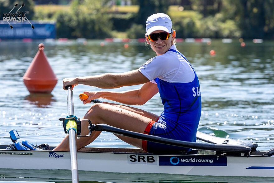
In early March 2016, Erik Dresser and I went out to Chula Vista to photograph the teams in training, partly for row2k and partly for photos for use by USRowing. I took a drone out as well, and Erik filmed a couple practices for the coaches to see blade angles, run, etc. The video turned out pretty great, including a segment where the crew rowed straight into and through a sunbow that could only be seen from the sky. Good times.
(As an aside, for coaching purposes, drone photos are often interesting and do offer some information, although I have found they are not always super useful; instead they reinforce things you already know from following a crew around for weeks and months.)
After photographing three or four morning practices in succession, there was a break before the next crews launched for a late morning session, so I decided to hike up the hill with the drone, safely encased in a travel box.
The hike to the top of the hill isn't too hard, but you get up high enough to see over the hills to San Diego, and at the top I stopped to have a look around and figure out my options.

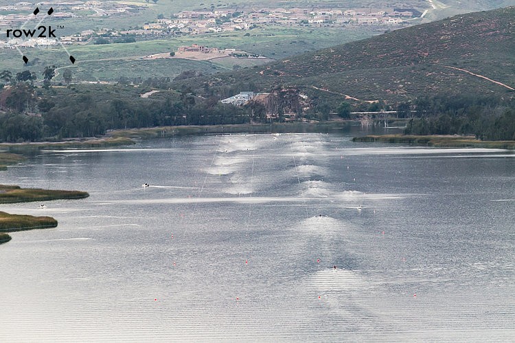
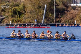
As I looked down the course, the future US 2016 women's double was nearing the bottom of the lake, and I quickly took a photo to my mind captures the lure and romance as well as the grind of training; a crew in the middle of nothing but water, trailed only by their puddles, and I grabbed the photo below.

As I started to unpack the drone, I scanned the valley created by Jamul Creek to the east, and noticed numerous helicopters in the area. There is a skydiving jawn a couple miles from the lake, and I thought it was those folks at first.
But there were too many of them, and critically I observed that all of the helicopters were actually below the elevation at the top of the hill; that is, they were flying below me. The hill is less than four miles from the border of Mexico, and the border patrol is fairly active there - and the copters flying below me were not skydiving enthusiasts; they were border patrol. I still opened the drone case and for a brief moment thought... nah, on the spot I decided that to put up a drone 400-500 feet above government helicopters wasn't the best idea - even in those somewhat simpler times.

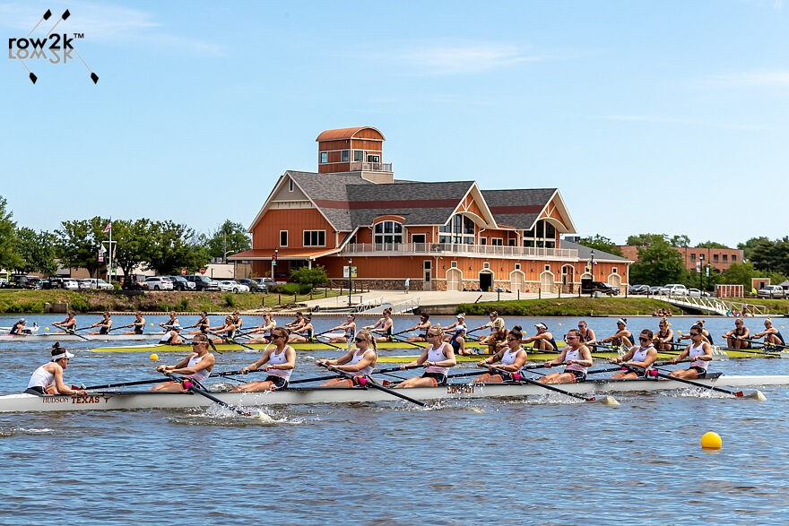
Later that day the camp women planned to do long loops on the lake in small boats, so we went back up the hill and shot straight down the course to get the photo at the top of this article. It would have been an epic drone photo, but a hilltop visit from the Feds wasn't on the list of things I was willing to do to get a rowing photo, so these will have to do.

If you enjoy and rely on row2k, we need your help to be able to keep doing all this. Though row2k sometimes looks like a big, outside-funded operation, it mainly runs on enthusiasm and grit. Help us keep it coming, thank you! Learn more.
Comments | Log in to comment |
There are no Comments yet
| |

- Bont Rowing
- Calm Waters Rowing
- Concept 2
- Craftsbury Sculling
- The Crew Classic
- CrewLAB
- Croker
- Durham Boat Co.
- Empacher
- Faster Masters
- Filippi
- Fluidesign
- h2row.net
- HUDSON
- Live2Row Studios
- Nielsen-Kellerman
- Oak Ridge RA
- Peinert Boat Works
- Pocock Racing Shells
- Race1 USA
- RowKraft
- Rubini Jewelers
- Vespoli USA
- WinTech Racing